
The Forgotten Islands
Why visit The Forgotten Islands
Few places in Indonesia offer the sense of genuine discovery that the Forgotten Islands still provide.
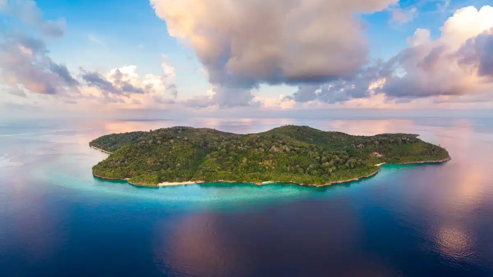
Known formally as the Southeast Moluccas, or Maluku Tenggara, the Forgotten Islands form a chain of archipelagos stretching more than one thousand kilometers from Timor toward West Papua. Because the region is so rarely visited, in some cases not at all by divers, much of it remains genuinely unspoiled. The islands form two arcs, an inner arc of volcanic peaks reaching heights of more than eight hundred meters, and an outer arc of flatter, uplifted limestone islands. Most voyages are crossing itineraries departing from Timor or Flores. Trip length, exact route, and marine activities depend on the vessel and operator.
This is not a polished destination with a settled circuit of named sites and daily departures. It is a genuinely remote chain of islands, some inhabited by only a handful of people, where the terrain shifts from forested volcanic peaks to flat, savannah-covered limestone within a single itinerary. For travellers who have already done Komodo or Raja Ampat and want somewhere further off the map, the Forgotten Islands are among the last places in Indonesia that still deliver that feeling.
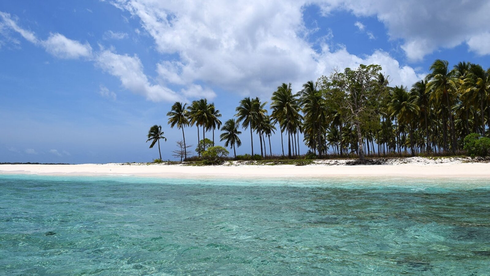
Among the least-visited waters in Indonesia
A one thousand kilometer chain rarely visited by liveaboards, with some sites, in the operators' own accounts, essentially undived.
Two distinct landscapes in one trip
The volcanic Inner Arc and the flatter limestone Outer Arc offer genuinely different terrain and reef structure within a single itinerary.
A true sense of exploration
Navigation on some routes still relies on secondhand waypoints and local knowledge rather than a settled, well-mapped circuit.
Distinct island cultures
The peoples of Maluku Tenggara share related languages, myths, and traditions, along with distinctive woodcarving, ikat weaving, and basketry.
Two arcs, one long chain
The Forgotten Islands are commonly described as an inner arc and an outer arc, each with a different geological origin and character, connected by open-water crossings.
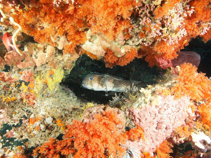
Wetar, Roma, Damar and Nila
Mountainous, volcanic islands with lush rainforest above the surface and diverse coral reefs below, well suited to muck diving. Damar's peak reaches nearly nine hundred meters, giving the inner arc a dramatically different profile from the outer islands.
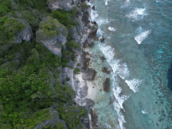
Leti, Luang, Sermata and Babar
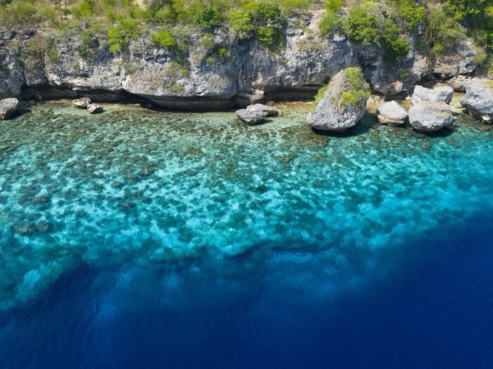
Flatter islands of uplifted coralline limestone, often terraced from repeated geological uplift and changing sea levels, with reefs that step down as walls into deep water rather than sloping gradually.
Dai and Babar
A common stretch on southern Banda Sea crossing itineraries, known for beautiful reefs and schools of jackfish, connecting the Banda Sea proper to the more remote outer arc islands further south and east.
Marine life and dive sites
Compiled from public dive references and kept current by PhinisiGO.
Because so little of the Forgotten Islands has been formally surveyed, much of what operators know about the reefs here comes from their own repeated visits rather than published dive guides. That makes every itinerary a little different, and every trip report worth reading before you go.
Nusa Laut Coral Gardens
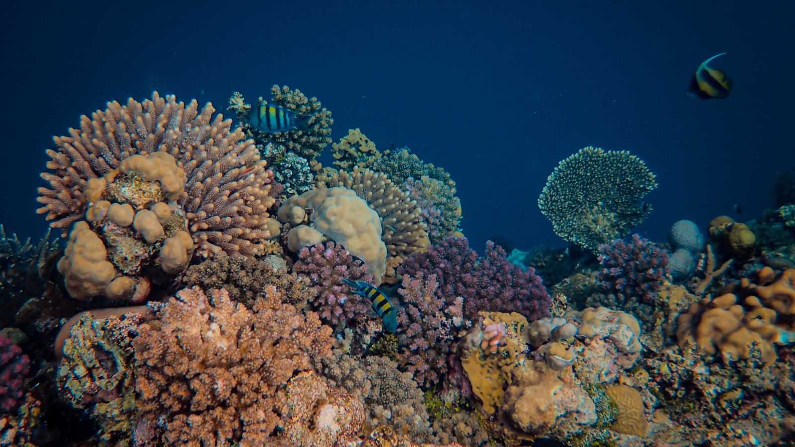
Some of the region's prettiest coral gardens, with lush greens and turquoise hues best appreciated with a dive torch even in daylight, alongside shoals of anthias and patrolling barracuda.
Dai Island Slopes
Steep slopes offering both shallow and deeper diving options, covered in healthy coral growth typical of the inner volcanic arc.
Terbang Selatan and Terbang Utara
Deserted islands with steep walls and pristine coral gardens on top of the reef, seeing very little dive traffic given their remote location.
Nil Desperandum
An underwater seamount rising to around three meters below the surface in the middle of the Banda Sea, known for pelagic encounters including tuna and rainbow runners alongside unspoiled coral.
Gunung Api (Southern)
An active volcano known for its resident population of sea snakes and seabirds, with huge barrel sponges and hard and soft coral covering its dramatic lava formations.
Koon and the Kei Islands
Outer arc sites visited on select itineraries, offering isolated reef systems well outside the range of a typical Indonesian liveaboard route.
Beyond diving
Topside activities that make The Forgotten Islands workable for mixed groups of divers and non-divers.
Genuinely remote anchorages
Many nights are spent at anchor off islands with only a handful of residents, some visited by few if any other liveaboards each year.
Distinct island cultures
Woodcarvings, ikat weaving, and basketry traditions specific to the peoples of Maluku Tenggara, connected by shared language and mythology.
Varied island terrain
From the forested volcanic peaks of the inner arc to the flat, terraced limestone of the outer arc, the topside scenery changes considerably across the route.
Sea snake encounters
Gunung Api's population of sea snakes offers a distinctive, if not universally comfortable, topside and shallow-water sighting for interested travellers.
Getting there
Forgotten Islands voyages typically depart from Flores or Timor, most commonly through Maumere (MOF) or Kupang (KOE), both reachable via Bali (DPS) or Jakarta (CGK) with a connection. Because most itineraries are long crossings, frequently paired with the Banda Sea, many travellers fly into one city and out of another, requiring more flexible planning than a standard round trip. Given the remoteness of the route, arriving with a buffer day before embarkation is strongly advised.
Liveaboards sailing The Forgotten Islands
Example vessel profiles using the same listing structure as the main Liveaboards page.
Loading liveaboards…
The Forgotten Islands voyage guides
Practical planning topics connected to this destination, without replacing current information from the vessel operator.
Best time to sail the Forgotten Islands
A practical overview of seasons, sea conditions, rainfall, and the periods most commonly used for liveaboard itineraries.
Reaching Maumere or Kupang
A simple planning outline for flights, arrival timing, hotel nights, and transfers before joining a Forgotten Islands crossing.
The Forgotten Islands or the Banda Sea?
Compare the two remote eastern Indonesian destinations by access, typical voyage length, marine life, and how each fits into a crossing itinerary.
The Forgotten Islands — frequently asked questions
Independently compiled planning answers, kept current by PhinisiGO.
What is the best time to visit the Forgotten Islands?
Two to three month windows early and late in the year, aligned with the regional dry season, are generally considered best. These periods frequently overlap with the timing of liveaboard crossing trips through the wider Banda Sea region.
How long should a Forgotten Islands trip be?
Most itineraries run ten to sixteen nights as a crossing, often combined with the Banda Sea given the two regions' geographic proximity and shared departure points on Flores or Timor.
What certification do I need?
Many sites around the Forgotten Islands are exposed to strong currents and are best suited to experienced divers. Some alternative sites nearby offer calmer, more relaxed diving, so confirm the specific route and site mix with your operator.
Why are they called the Forgotten Islands?
The name reflects how rarely this one thousand kilometer chain of archipelagos is visited, a result of its remoteness from Indonesia's population centers and its distance from any well-established tourist route.
What should I bring for navigation uncertainty on this route?
Because some dive sites are marked only by secondhand waypoints and local knowledge, carrying a surface marker buoy and a finger spool is a sensible precaution recommended by several operators, in case of an unplanned surfacing away from the liveaboard.
Search Liveaboards in The Forgotten Islands
Compare vessel profiles, listing status, capacity and pricing basis, then send an enquiry to PhinisiGO, your first point of contact for booking.